European seafloor litter standardized, harmonized and validated datasets 2006/2018 v2019
Dataset extent
Map data © OpenStreetMap contributors
Tiles by MapBox
Tags
Data and Resources
To access the resources you must log in
-
Direct downloadZIP
Direct download
The resource: 'Direct download' is not accessible as guest user. You must login to access it!
Geonetwork Links
Additional Info
| Field | Value |
|---|---|
| access_constraints | ["Usage is subject to mandatory citation: \"This resource was generated in the framework of EMODnet Chemistry, under the support of DG MARE Call for Tender EASME/EMFF/2016/006 - lot4.\""] |
| bbox-east-long | 30.233 |
| bbox-north-lat | 61.7546 |
| bbox-south-lat | 36.0183 |
| bbox-west-long | -15.397 |
| contact-email | nodc@ogs.trieste.it |
| coupled-resource | [] |
| dataset-reference-date | [{"type": "creation", "value": "2019-05-10"}] |
| graphic-preview-file | 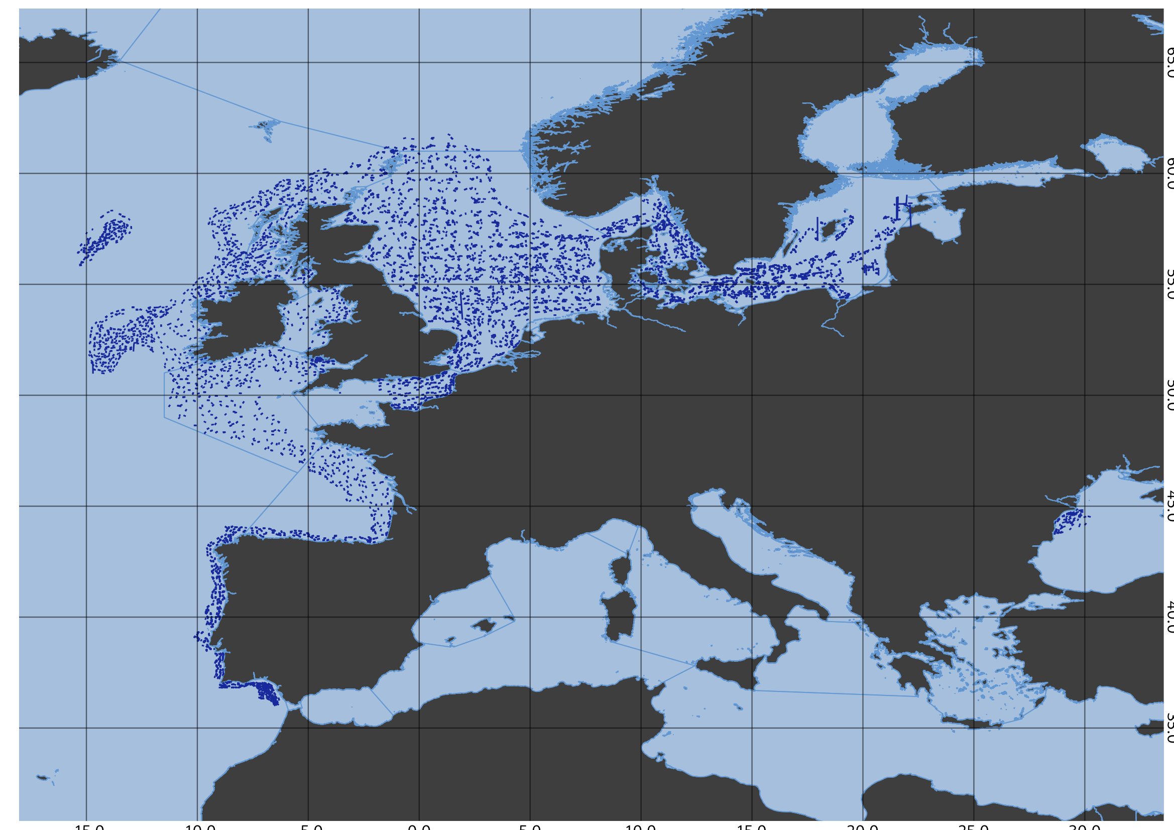 |
| GUID | dd00c70e-73be-4faa-aab0-0d5f7a438d5e |
| licence | [] |
| metadata-date | 2019-10-30T09:06:43 |
| metadata-language | eng |
| point_of_contact 1 | nodc@ogs.trieste.it |
| point_of_contact 2 | rmri@rmri.ro |
| resource-type | series |
| responsible-party | [{"name": "UNKNOWN", "roles": ["originator"]}, {"name": "National Institute for Marine Research and Development \"Grigore Antipa\"", "roles": ["originator"]}, {"name": "OGS (Istituto Nazionale di Oceanografia e di Geofisica Sperimentale), Division of Oceanography", "roles": ["author"]}] |
| spatial | {"type": "Polygon", "coordinates": [[[-15.397, 36.0183], [30.233, 36.0183], [30.233, 61.7546], [-15.397, 61.7546], [-15.397, 36.0183]]]} |
| spatial-reference-system | WGS 84 (EPSG 4326) |
| spatial_harvester | true |
| system:type | Series |
| temporal-extent-begin | 2006-01-10 |
| temporal-extent-end | 2018-08-16 |
| topic_category | oceans, environment |
Management Info
| Field | Value |
|---|---|
| Author | EMODnet Chemistry |
| Maintainer | iMarine Catalogue Manager |
| Last Updated | 12 December 2019, 19:53 (CET) |
| Created | 12 December 2019, 19:52 (CET) |